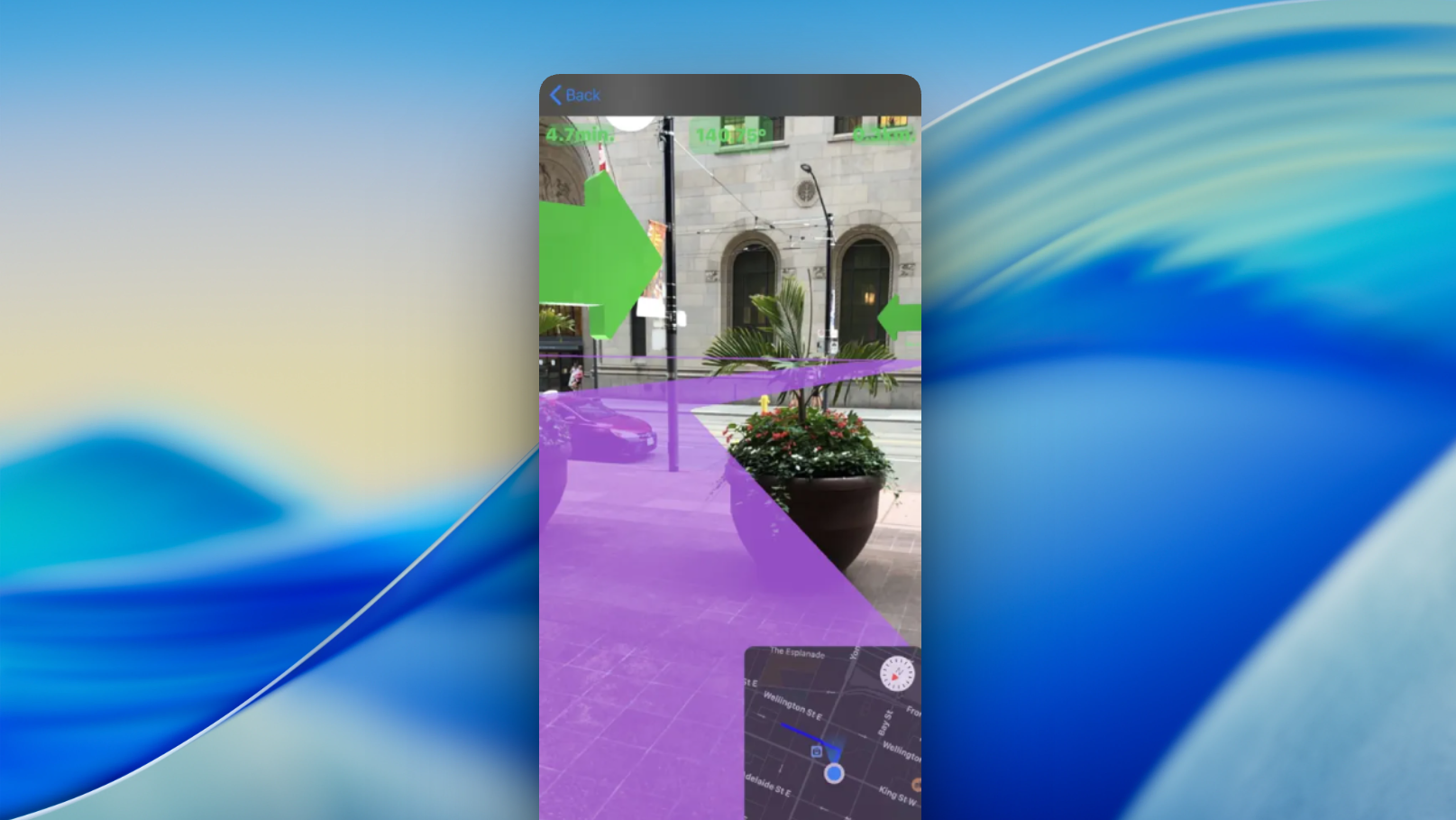
Task
The project's task is to create a simple, interactive and visually clear AR map tool that helps users orient themselves in space faster and receive navigation information and visual cues right on their phone screen, integrating maps with the surrounding world.
Work stages
⦁ Analytics
AR technologies, mobile apps with maps and navigation, and user scenarios for AR orientation — from city walks to tourist routes — were analyzed.
⦁ Design
A minimalist, intuitive interface was created. AR markers, routes and points of interest are designed with bright visual elements that do not interfere with the perception of the surrounding world.
⦁ Development and testing
AR visualization of routes and POIs was implemented and optimized for iOS (ARKit) and Android (ARCore). Testing of positioning accuracy, stability of AR objects during movement, interface responsiveness and stable operation in various lighting conditions was carried out.
Features
- Route visualization through AR technology
- Display of POIs (points of interest) right in space
- Interactive markers with descriptions, photos and navigation
- Support for different mapping engines
- Intuitive gestures for interacting with AR elements
- Adaptation for pedestrian routes and city navigation
Results
- A functional AR navigation tool for everyday use was created
- Spatial orientation was improved thanks to AR visualization
- Users get access to information about routes and landmarks in a more visual format
Reviews
“Our goal was to make navigation not only useful but truly convenient and visually appealing. The team successfully built AR MAP, integrating augmented reality into traditional mapping features. As a result, users can orient themselves in space much more easily and clearly, visualizing routes right in front of them. We are pleased with how the project came to life and with the feedback received from the first users.”